Saturday, June 28, 2014


Sunday, June 1, 2014
Thursday, March 28, 2013


Monday, December 31, 2012
Saturday, December 22, 2012
Saturday, December 15, 2012


Friday, March 30, 2012
Monday, March 5, 2012



Friday, January 7, 2011
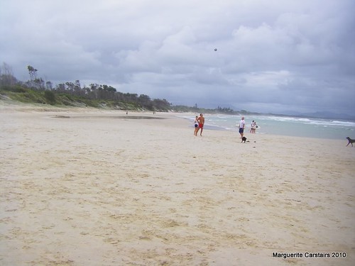
Beach at Byron Bay
Here, where the Coral Sea to the north meets the Tasman Sea in the south, Cape Byron protrudes into the Pacific Ocean and forms the most easterly point of the Australian mainland. Dramatic views from the headland are your reward for walking to the lighthouse (you can drive, but it takes the drama out of the scenery, and it will cost you $6 to park your car). From the Cape you will see stunning views over the Bay to Mt Warning and the Border Ranges, or south over Tallow Beach to Broken Head in the distance.
It may be a surprise, but Cape Byron is not all sand and surf. If you walk up Lee Lane from the Captain Cook lookout (off Lighthouse Road) you will find yourself in littoral (coastal) rainforest, with banksias, Bangalow palms, cabbage palms and melaleuca species. Emerging from the rainforest, you'll be rewarded by a wonderful view to the south along Tallow Beach and maybe by hang-gliders taking off from the wooden platform.
A few more hundred metres and you come past the historic lighthouse cottages, to the lighthouse itself (www.lighthouse.net.au) and then down the path to the extreme easterly point. Continue down the hill to Little Watego's and Watego's beaches and back along the paths to Byron Bay. You will almost certainly see pods of bottlenose dolphins from up here, and possibly rays and sea turtles.
In the appropriate seasons, Cape Byron is one of the best vantage points for whale-watching. From the end of June to August, the huge mammals migrate northwards to calve in the warm northern waters. Then, in September and October, they return with their new babies, sometimes stopping in the Bay for some whale R&R and to teach the young ones 'breaching' and 'slapping'. Most whale sightings are of humpbacks, distinctive by their spinal shape, but it's also possible to see other species.
However, back to the beaches. Gleaming white tiny-grained sand and clear turquoise-blue water only occasionally sullied by the debris of storms are what you can expect in Byron. Sometimes after a strong northerly wind 'cornflakes' - scraps of floating seaweed - appear in the waves, turning them a greenish-brown rather than the usual aquamarine. But nearly all year round, the water and the beaches invite luxurious sunbathing and clean swimming.
Byron Shire offers over 30km of beaches, from the busy, patrolled (in summer) beaches near the town, to isolated coves, nudist and dog-friendly beaches within 10-15 minutes drive. Ranging in temperature from around 18°C in the winter to 26°C in the summer, the water is perfect for most of the year, and only slightly chilly in winter. All year round, wear a hat and high-rating sunscreen as, even in winter, the Australian sun burns
Rick from byronbay.com here... Just a quick note;
We've been publishing the popular byronbay.com website since 1997
(more details on attached PDF).
We are just about to launch a huge update to the site... as part of
that we are going through our existing content...
We noticed that you have used some of our content, we are happy to
allow this so long as you credit www.byron-bay.com with a link to us
on your page.
Our page; http://www.byron-bay.com/byronbay/beachguide.html
Lighthouse at Byron Bay
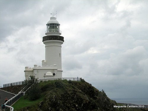
Byron Bay Lighthouse
Standing on a bald rocky headland with a precipitious cliff on the east side, and a sheer drop of approximately 100 metres, Cape Byron Lighthouse is the most easterly light in Australia, and one of the most powerful.
Built in the style used by NSW colonial architect, James Barnet, Charles Harding his successor, prepared the plans for the Cape Byron Lighthouse. Due to the elevation of the site, a tall structure was not required. Construction began in 1899 with the levelling of the site by contractors, Mitchell and King. The total cost was £10,042 (pounds) to the contractors, £8,000 for the apparatus and lantern house, and £2,600 for the road from Byron Bay township.
Tower Construction
The tower is constructed from concrete blocks made on the ground, lifted and cemented into position and finally cement rendered inside and out. This technique saved erecting framework.
The Lens
The eight ton optical lens was made by the French company, Societe des Establishment, Henry Lepante, Paris. It is a dioptric first-order bivalve double flashing lens and contains 760 pieces of highly polished prismatic glass. The lens revolves on a bath of 7cwt mercury. The original illuminant was a concentric six-wick kerosene burner. This was replaced in 1922 by a vaporised kerosene mantle burner, which increased the intensity from 145,000 cp to 500,000 cp. In 1956, the light was converted to mains electricity increasing the intensity to 2,200,000 cd.
The original lens weight driven mechanism, which works on a similar principle as that of a grandfather clock, was also replaced with an electric drive motor when the light was converted to electric operation. An auxiliary fixed red light is exhibited from the tower to cover Julian Rocks to the north.
The Event
The installation of the lighthouse was regarded as a great event in the district of Byron Bay. A banquet was arranged and special trains carried visitors from Lismore and Murwillumbah for the opening. The Premier of the day, the Hon. John See (later Sir John See), was accompanied by a number of his colleagues who left Sydney in the Government steamer 'Victoria'. However, bad weather prevented the vessel from arriving on time, and when the party should have been banqueting the steamer was some thirty miles away. She arrived in the bay just before midnight on 30 November 1901, but again, the weather made it impossible for the party to land until dawn.
The Lighthouse Opened
After landing, the party was informed that the banquet had taken place on the previous evening, and the necessary toast had been heartily drunk in the absence of the Premier and his party. Mr See, after making an acrobatic performance in landing, was cordially cheered, and later formally welcomed at the Great Northern Hotel. Interestingly, the lighthouse was christened with a rich and sumptuous vintage burgundy - not dashed against the tower to waste, but sipped by the ladies and legislators to compensate for having missed all the good things of the banquet held the night before.
Visit our Cape Byron Headland Reserve page for more information on the Cape.
Courtesy Cape Byron Trust
Tuesday, December 21, 2010
UnderwaterCoral Reefs at the Phoenix Islands

Settling down beside the reef, I saw dead coral everywhere. What had been flourishing, overlapping, overflowing brown and auburn plates of corals were now ghostly, broken reminders of their former beauty. When I'd first visited the Phoenix Islands a decade ago, these reefs had supported numerous species of hard corals, as well as giant clams, sea anemones, nudibranchs, and great populations of fish, from blacktip reef sharks to parrotfish to bohar snappers. Because the islands have remained undisturbed for so long, they'd largely avoided overfishing, pollution, and other harmful impacts of modern civilization. But they hadn't been able to avoid climate change, which most scientists believe amplifies El Niños.
http://ngm.nationalgeographic.com/2011/01/phoenix-islands/stone-text http://ngm.nationalgeographic.com/2011/01/phoenix-islands/stone-text
Monday, December 13, 2010
Palm Island
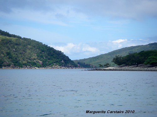
We stayed at Palm Island mooring amidst the islands where it was protected from the open winds.
It was very beautiful there. Shore was rich with trees and greenery and white cockatoos called from the trees.
The settlement was ahead.
Most of Palm Island is simply open land and full of bush and birds... a real Sanctuary.
The next day we went by Dinghy to Famtome Island which was the Leprosy Hospital base.
The shore was laden with coral and smooth colored stones.
As we walked into the Island there were piles of conch shells that had been eaten by a campfire.
The island is rich with trees, flowers and birds.
It is a very beautiful island currently uninhabited.
Tuesday, December 7, 2010
Sunken Yacht had been dragged by the current over 11 miles
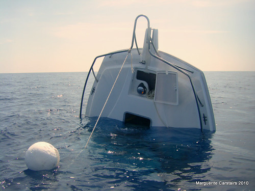
We found it on Tuesday.
Coastguard said it had sunk at 1am on Friday and was dragged away by the currents.
It had traveled 11 miles to where we located it at Wheelers Reef
Monday, December 6, 2010
Palm Island Hospital site
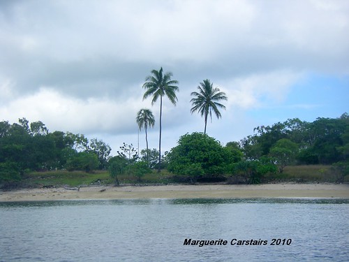
http://www.slq.qld.gov.au/info/ind/community/missions/mainland/f-g
Fantome Island
Fantome Island was gazetted as an Aboriginal reserve in 1925. Aboriginal patients suffering from venereal disease were first taken to the island in 1928. Fantome Island became part of the Palm Island reserve in 1938. The island was proclaimed a lazaret in 1939 and opened in January 1940. All Aboriginal patients from the lazaret on Peel Island in Moreton Bay were transferred to Fantome Island in 1940.
In 1941 it was decided that as a treatment facility for venereal diseases and a lazaret existed on Fantome Island, the areas allocated to the two institutions should be clearly defined. This resulted in half the Island being re-gazetted as a reserve for Health Purposes (for the reception and medical treatment of lepers) and the other half re-gazetted as a reserve for the medical treatment of Aboriginals suffering from venereal disease.
Nearby Orpheus Island was also considered as a place to establish a camp for Aboriginal people suspected to have leprosy. In 1939 the island was visited by missionaries from Mona Mona mission who were seeking to remove suspected lepers from Mona Mona. Orpheus Island, however, was found to be an unsatisfactory location and no suspect camp was ever established.
In 1945 the Lock Hospital was closed down and the administration of the lazaret was taken over by the Franciscan Missionaries of Mary. According to the 1944/45 Annual Report of the Director-General of Health and Medical Services the use of penicillin at Palm Island had made it possible to close the isolation settlement at Fantome Island. The lazaret on Fantome Island did not close until around 1973 when the remaining six patients were removed to Palm Island. In 1975 the island was de-gazetted as a reserve for the treatment of leprosy patients.http://www.archivessearch.qld.gov.au/Search/AgencyDetails.aspx?AgencyId=4501
ESTABLISHMENT AND FUNCTION:
Under the "Health Act of 1937", the Governor-in-Council, by proclamation, could appoint any place to be a lazaret for the reception and treatment of lepers.
On 11 May 1939, Fantome Island in the Palm Island Group, North Queensland, was proclaimed a lazaret for the treatment of aborigines with leprosy. In Jul 1939 there were 15 patients at Fantome Island and, in Jan 1940, a further 49 patients were transferred from Peel Island Lazaret.
With improvements in treatment the number of patients gradually decreased, particularly in the 1950s, and, in 1973, patients with Hansen's Disease, as leprosy was now called, were transferred to Palm Island Hospital.
Beach at Palm Island
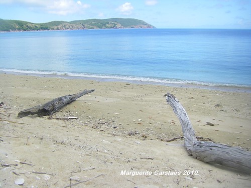
http://en.wikipedia.org/wiki/Palm_Island,_Queensland
Palm Island, also known as Great Palm Island, or by the Aboriginal name Bwgcolman,[3] is a tropical island with a resident community of about 4,000 people. The settlement is named variously Palm Island, the Mission, Palm Island Settlement or Palm Community.[4] The island is situated 65 kilometres north-west of Townsville, on the east coast of Queensland, Australia 800 kilometres north of the Tropic of Capricorn. It is the main island of the Greater Palm group, and consists of small bays, sandy beaches and steep forested mountains rising to a peak of 548 metres.[5] Neighbouring islands outside the Palm group include Rattlesnake Island and Magnetic Island.
Palm Island Jetty
Palm Island is often termed a classic "tropical paradise" given its natural endowments, but it has had a troubled history since the European settlement of Australia.[6] For much of the twentieth century it was used by the Queensland Government as a settlement for Aboriginals considered guilty of such infractions as being "disruptive", being pregnant to a white man or being born with "mixed blood".[7]
Monday, September 6, 2010
Maggi by the Statue at Yangquan China
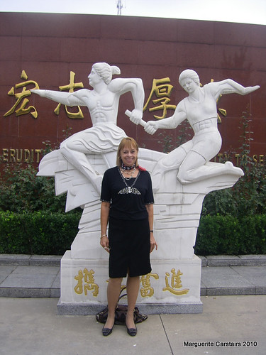
I am at Yangquan in China
Yangquan is inland and far from the coast.
It is 6 hours drive from Beijing.
It is a huge city with many exciting features and sights.
I have been to the Supermarket and a local market.
The city is high and surrounded by mountains and 20 kms from the Great wall at Yangquan, which we passed when driving here.
Movie_NoodleMakerYangquan
Movie_NoodleMakerYangquan, originally uploaded by Ladymaggic.
The noodle maker makes the noodles for boiling and selling at a roadside stall in Yangquan
He is very skilled at his task.
http://sunrisetoday.wordpress.com
View from front window to Gate in China
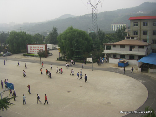
This is the view I get from my apartment window in China.
I am at Yangquan which is 6 hours drive from Beijing inland.
Please view my blog in China http://sunrisetoday.wordpress.com
It is the only website i can access whilst living in China
Monday, August 30, 2010
New Moon and first star of 17 August at Burrum Heads

Here is the daily weather for Burrum Heads
http://www.weatherzone.com.au/qld/wide-bay-and-burnett/burrum-heads
Pink Sunset at Burrum Heads Queensland 17 August 2010


About Me
140x45.jpg)
Networked Blogs

Subscribe To Coastal Art


 Posts
All Comments
Posts
All Comments