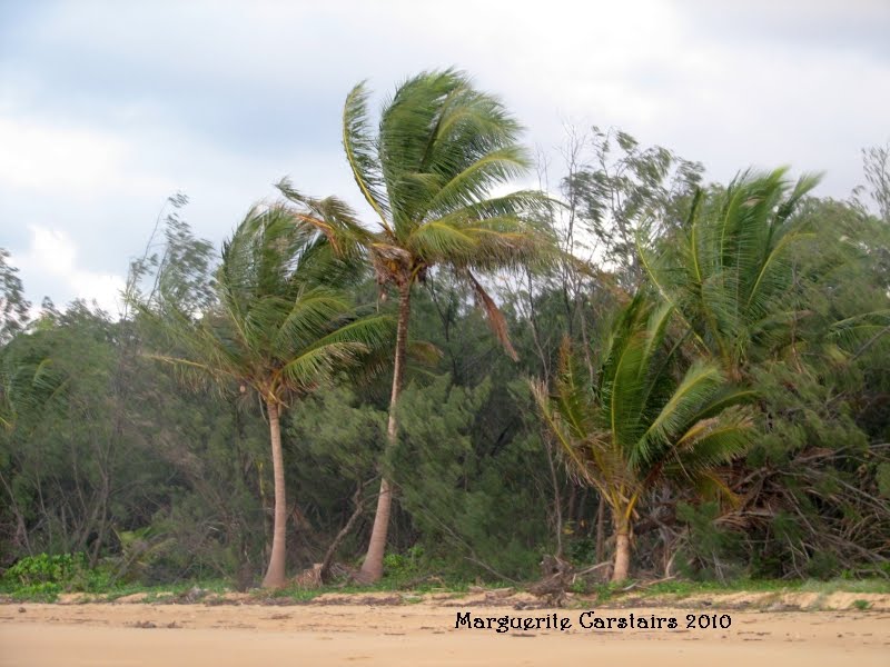
Beautiful coconut palms at Mission Beach.
Photographs and Art from Places on the Coast of East Australia. Gold Coast, Stradbroke Island, Burrum Heads, Hervey Bay and surrounding coastal areas
Showing posts with label australia. Show all posts
Monday, August 30, 2010
Friday, July 23, 2010
St Lawrence Queensland
Am at The St Lawrence Polo Grounds which is now a free caravan park for travellers with their own vans, tents or vehicles.
It is one of the best sites I have stayed at with the best and cleanest toilets and facilites.
It only misses Power, and right now I am sitting in a Luxury caravan helping Mary try to decipher security codes whilst I am using their power using their generator and electricity.
The Location was a Caravan Park, but now it is private property owned by the Polocross Club, who permits free parking to bring people into the town, whoich consists of a shop and a Post Office and a Railway Station.
The area is all bush rich with birdlife and trees, with glorious sunsets and sunrises.
http://www.broadsound.qld.gov.au/visitors/InfoStLawrence.shtml
St Lawrence
St Lawrence is situated approximately 155km south of Mackay, 177km north of Rockhampton and 6km east of the Bruce Highway. The town has a varying population of approximately 150 with the main employers for the town being Broadsound Shire Council and Queensland Railways. One of the oldest towns on the coast, its demure is firmly linked to its historical beginnings which are well seen about the town. Several cattle properties surround the town and it also supports a locally based professional fishing industry.
The township was established originally to service a major port facility in Broadsound which is no longer used. One historical building still remaining from this time is the Shire Office. Originally built to service the Customs Office for the Port of St Lawrence, it was sold to the Shire of Broadsound for 100 pounds in 1901. The remains of the Port and Abattoir constructed using convict labour are also accessible. The Court House/Police Station was built in 1879 and has been repainted in its original colour scheme.
St Lawrence has a school with education to Grade 7 and an occasional childcare service operates in the town once a week.
St Lawrence has a hotel, two grocery stores, a post office, an electricity depot, honorary ambulance service and a police station. Limited banking with the Commonwealth Savings Bank and Pioneer Permanent Building Society can be conducted from the Post Office. Passenger trains can be utilised approximately four (4) times a week north and south of St Lawrence. A daily bus service is also available.
The Centenary Pavillion located at the Sportsground (beside the tennis courts) was constructed to celebrate the Shire's Centenary in 1979 with the collection of past machinery and relics. The Pavillion is open 24 hours a day for viewing
The town’s sporting facilities include Lawn bowls which is played on a green situated next to the Community Hall. There is a 9 hole golf course, tennis courts and a small swimming pool available for use. There are weekly darts competitions at the Hotel and annual sports days held at the sportsground facilities. St Lawrence Creek is also a favourite recreational fishing area. In the cooler months the Recreation Group hold a weekend of Gymkhana and Campdraft and the Polocrosse Club have their Annual Polocrosse Weekend. The Recreation Grounds on the outskirts of town provide all year round camping facilities and amenities for travellers and is available for hire for functions.
The Anglican Church was built in 1898. Prior to its construction, services were held quarterly in the Courthouse. The 100th Anniversary of the church was marked with an ‘open’ party on May 17, 1998. Services are held at both the Anglican and Catholic Churches.
The St Lawrence Cemetery has also been noted as historically important.
Although not all graves are marked, there is a register held at the Broadsound Shire Council Library at St Lawrence listing most of the graves, with some dating back to the 1800’s
The Craft Centre, located in the main street, exhibits local crafts for sale. Part proceeds from these sales go towards the Queensland Ambulance Service.
The Historical Railway Building is also located in the main street of St Lawrence. The old railway station has been recently restored and the St Lawrence Library and Internet Café have been established for use by both the local community and visitors to the area.
It is one of the best sites I have stayed at with the best and cleanest toilets and facilites.
It only misses Power, and right now I am sitting in a Luxury caravan helping Mary try to decipher security codes whilst I am using their power using their generator and electricity.
The Location was a Caravan Park, but now it is private property owned by the Polocross Club, who permits free parking to bring people into the town, whoich consists of a shop and a Post Office and a Railway Station.
The area is all bush rich with birdlife and trees, with glorious sunsets and sunrises.
http://www.broadsound.qld.gov.au/visitors/InfoStLawrence.shtml
St Lawrence
St Lawrence is situated approximately 155km south of Mackay, 177km north of Rockhampton and 6km east of the Bruce Highway. The town has a varying population of approximately 150 with the main employers for the town being Broadsound Shire Council and Queensland Railways. One of the oldest towns on the coast, its demure is firmly linked to its historical beginnings which are well seen about the town. Several cattle properties surround the town and it also supports a locally based professional fishing industry.
The township was established originally to service a major port facility in Broadsound which is no longer used. One historical building still remaining from this time is the Shire Office. Originally built to service the Customs Office for the Port of St Lawrence, it was sold to the Shire of Broadsound for 100 pounds in 1901. The remains of the Port and Abattoir constructed using convict labour are also accessible. The Court House/Police Station was built in 1879 and has been repainted in its original colour scheme.
St Lawrence has a school with education to Grade 7 and an occasional childcare service operates in the town once a week.
St Lawrence has a hotel, two grocery stores, a post office, an electricity depot, honorary ambulance service and a police station. Limited banking with the Commonwealth Savings Bank and Pioneer Permanent Building Society can be conducted from the Post Office. Passenger trains can be utilised approximately four (4) times a week north and south of St Lawrence. A daily bus service is also available.
The Centenary Pavillion located at the Sportsground (beside the tennis courts) was constructed to celebrate the Shire's Centenary in 1979 with the collection of past machinery and relics. The Pavillion is open 24 hours a day for viewing
The town’s sporting facilities include Lawn bowls which is played on a green situated next to the Community Hall. There is a 9 hole golf course, tennis courts and a small swimming pool available for use. There are weekly darts competitions at the Hotel and annual sports days held at the sportsground facilities. St Lawrence Creek is also a favourite recreational fishing area. In the cooler months the Recreation Group hold a weekend of Gymkhana and Campdraft and the Polocrosse Club have their Annual Polocrosse Weekend. The Recreation Grounds on the outskirts of town provide all year round camping facilities and amenities for travellers and is available for hire for functions.
The Anglican Church was built in 1898. Prior to its construction, services were held quarterly in the Courthouse. The 100th Anniversary of the church was marked with an ‘open’ party on May 17, 1998. Services are held at both the Anglican and Catholic Churches.
The St Lawrence Cemetery has also been noted as historically important.
Although not all graves are marked, there is a register held at the Broadsound Shire Council Library at St Lawrence listing most of the graves, with some dating back to the 1800’s
The Craft Centre, located in the main street, exhibits local crafts for sale. Part proceeds from these sales go towards the Queensland Ambulance Service.
The Historical Railway Building is also located in the main street of St Lawrence. The old railway station has been recently restored and the St Lawrence Library and Internet Café have been established for use by both the local community and visitors to the area.
Sunday, July 18, 2010
Dense undergrowth at Djuiru Park
The dense undergrowth at the Tam O Shanter National Park, now known as the Djuiru National P{ark at Mission Beach.
The walk across was closed and so was the other walks closer to the beach.
This is a Cassowary Protection Area
The walk across was closed and so was the other walks closer to the beach.
This is a Cassowary Protection Area
Balgal Beach Boatramp
Balgal Beach
Beautiful Beach north of Townsville marred only by the sandflies who have feasted on my body every morning and evening while I enjoy the the sunrise and sunset. Even now, I am being eaten alive while I type this at the Cafe Outside area.
I am at a 48 hour Council Caravan Park right on the beach and enjoying the quiet and the peace and beauty.
Balgal Beach is a beachside community popular as a day and overnight trip destination for locals and tourists to Thuringowa and Townsville. Just a few minutes from Rollingstone, Balgal Beach features a stinger net, which is installed and patrolled from November to May, and an excellent boat ramp facility with easy access to the Palm Island group. It boasts a superb sand beach as well as a wide creek mouth and is a renowned beach and river fishing location.
Other activities include visiting the Anzac memorial, viewing the interpretive historic signage, having a picnic and barbecue at the park, bird watching and fishing.
There is also a licensed cafe and a variety of accommodation which includes Holiday Units, Bed and Breakfast Retreat, and Council's two designated limited tent camping and vehicle camping areas. Download the flyer from their websites for more information on free camping.
http://www.queenslandholidays.com.au/things-to-see-and-do/balgal-beach-9001758/index.cfm
Beautiful Beach north of Townsville marred only by the sandflies who have feasted on my body every morning and evening while I enjoy the the sunrise and sunset. Even now, I am being eaten alive while I type this at the Cafe Outside area.
I am at a 48 hour Council Caravan Park right on the beach and enjoying the quiet and the peace and beauty.
Balgal Beach is a beachside community popular as a day and overnight trip destination for locals and tourists to Thuringowa and Townsville. Just a few minutes from Rollingstone, Balgal Beach features a stinger net, which is installed and patrolled from November to May, and an excellent boat ramp facility with easy access to the Palm Island group. It boasts a superb sand beach as well as a wide creek mouth and is a renowned beach and river fishing location.
Other activities include visiting the Anzac memorial, viewing the interpretive historic signage, having a picnic and barbecue at the park, bird watching and fishing.
There is also a licensed cafe and a variety of accommodation which includes Holiday Units, Bed and Breakfast Retreat, and Council's two designated limited tent camping and vehicle camping areas. Download the flyer from their websites for more information on free camping.
http://www.queenslandholidays.com.au/things-to-see-and-do/balgal-beach-9001758/index.cfm
Saturday, July 10, 2010
Sunday, June 13, 2010
Waterlilies
The waterlilies at Double Laggon Normanton
Labels:
australia,
Double Lagoon,
Dugongs Queensland,
Normanton,
Waterlilies
Tuesday, May 18, 2010
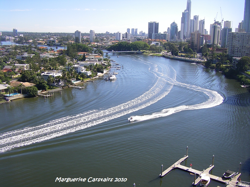
View from Hawaian
The River is beautiful...
Boats and watercraft make patterns on the water.
Labels:
australia,
Burrum River,
Gold Coast,
surfers paradise
Tuesday, April 13, 2010
Marina Burnett Heads Queensland
Burnett Heads is a thriving small community along the Coral Coast of Queensland, Australia, with temperate climate and year-long safe swimming at local sandy beaches
http://www.burnettheads.asn.au/
I had booked in at the Caravan Park here on recommendation from another traveler. I will never pre-book ever again. I usually select where I stay by seeing it and selecting my spot to camp.
After going to Bargara, where I should have stayed right on the ocean beachfront, I drove back to Burnett Heads and finally found the entrance to the Caravan park, where I parked right on the edge with a tinge of shade.... The owner assured me the sun was moving, and I would soon be in total shade.
Wrong!!!! the sun moved to set in the West and I spent a miserable afternoon in blistering heat, in front of my small portable fan wishing I had gone back to the sea. Had it set in the East, I would have got the promised shade.
The worst part was yet to come. Huge man-eating mosquitoes floated around adding to my discomfort.
I read a book with a can of fly spray in one hand, batting off indolent mossies looking for new blood and sweating profusely to attract them to the fact that though I appeared dead I was actually alive.
In the morning I was awake at 5.30 and decided to go explore before the heat got me. I forgot about the wildlife, and got bitten by midges, as well as mosquitoes, who were now humming melodies past my ears, as they came seeking an early breakfast of me.
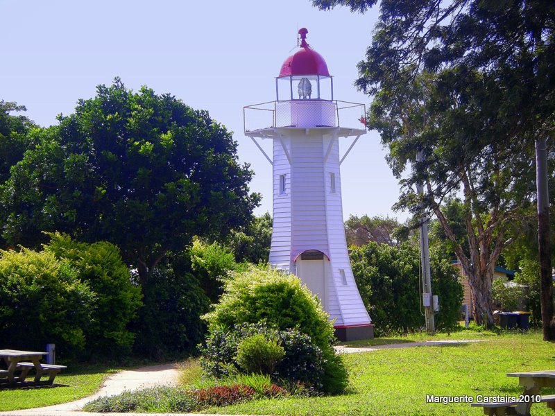
Behind the van is an area of grasses, and the river was mud with absolutely no scenery. I came here for the lighthouse, and it is sweet. It is located right next to the Caravan Park which takes its picturesque name from the Lighthouse.
I did get one sunrise photo, but the price was too high. I went back, had a shower, and departed to see the Marina. That was beautiful. I wondered if the Free Camping was at the Port where it was now closed. That would have been the place to stay as this area is very interesting.
There were some fishermen there preparing for the day, and the carpark was full.I drove around the car park and as the road to the Port was closed, I went off to find Bundaberg Port, and found the Bulk Sugar Handling Port instead. That was very interesting.
The lighthouse was constructed of timber in 1873.
It was a manned by a keeper from then till 1932 when it was converted to acetylene gas operation.
The lighthouse was been replaced by a modern structure in 1971 and has since been re-located one kilometre from its original site to the park in the main street of Burnett Heads where it has been restored.
The concrete base and steps can be still found at its original location next to the new tower.
http://www.burnettheads.asn.au/
I had booked in at the Caravan Park here on recommendation from another traveler. I will never pre-book ever again. I usually select where I stay by seeing it and selecting my spot to camp.
After going to Bargara, where I should have stayed right on the ocean beachfront, I drove back to Burnett Heads and finally found the entrance to the Caravan park, where I parked right on the edge with a tinge of shade.... The owner assured me the sun was moving, and I would soon be in total shade.
Wrong!!!! the sun moved to set in the West and I spent a miserable afternoon in blistering heat, in front of my small portable fan wishing I had gone back to the sea. Had it set in the East, I would have got the promised shade.
The worst part was yet to come. Huge man-eating mosquitoes floated around adding to my discomfort.
I read a book with a can of fly spray in one hand, batting off indolent mossies looking for new blood and sweating profusely to attract them to the fact that though I appeared dead I was actually alive.
In the morning I was awake at 5.30 and decided to go explore before the heat got me. I forgot about the wildlife, and got bitten by midges, as well as mosquitoes, who were now humming melodies past my ears, as they came seeking an early breakfast of me.
Behind the van is an area of grasses, and the river was mud with absolutely no scenery. I came here for the lighthouse, and it is sweet. It is located right next to the Caravan Park which takes its picturesque name from the Lighthouse.
I did get one sunrise photo, but the price was too high. I went back, had a shower, and departed to see the Marina. That was beautiful. I wondered if the Free Camping was at the Port where it was now closed. That would have been the place to stay as this area is very interesting.
There were some fishermen there preparing for the day, and the carpark was full.I drove around the car park and as the road to the Port was closed, I went off to find Bundaberg Port, and found the Bulk Sugar Handling Port instead. That was very interesting.
The lighthouse was constructed of timber in 1873.
It was a manned by a keeper from then till 1932 when it was converted to acetylene gas operation.
The lighthouse was been replaced by a modern structure in 1971 and has since been re-located one kilometre from its original site to the park in the main street of Burnett Heads where it has been restored.
The concrete base and steps can be still found at its original location next to the new tower.
Monday, March 1, 2010
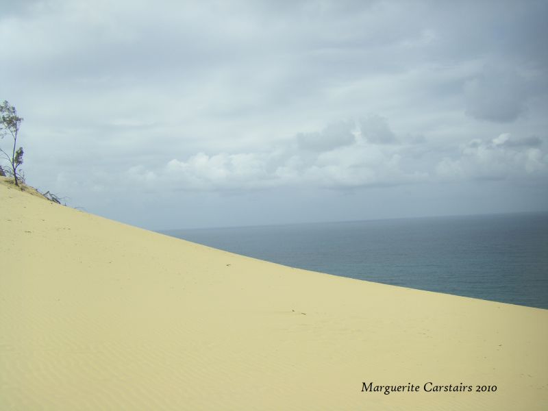
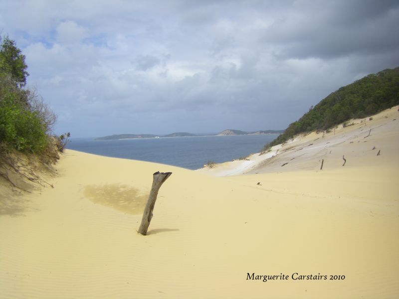
Carlo Sandblow at Rainbow Beach
This was a wonderful experience.
You can walk here along the beach at low tide from the Surf Club.
I parked at the end of Cooloola Drive, walked through a beautiful treed bush walk, up steps and down steps to the Sandblow. It looked like the desert...white, shining and very beautiful.
I walked down to the edge...it took about 20 minutes...
It was a calm and cloudy day. With wind blowing sand it would not be as easy to walk and enjoy.
http://www.rainbow-beach.org/content/view/79/243/http://www.rainbow-beach.org/content/view/79/243/
Carlo Sand Blow was named by Captain Cook after one of his deck crew named Carlo. The unique moonscape sand mass covers over 15 hectares and overlooks the towering colored sands. From the Rainbow Beach water tower at the top of Cooloola Drive, a walking track passes through woodlands to the expansive natural sand blow.
It’s an excellent spot to watch the sunrise or sunset. The 360 degree views are spectacular, to the East has magnificent views of the ocean where one can often see the migrating whales from August to October. To the S.E. is Double Island Point and the cliffs of colored sand. Fraser Island and Inskip Point are to the North, while Tin Can Bay and the Great Sandy Straits lie to the West.
CARLO SAND BLOW ON FOOT
A bush walk up to Carlo Sand Blow is a must. Drive to the reservoir at the top of Cooloola Drive. The Blow is an easy 600m walk from the car park. Spectacular views of the Colored Sands, Double Island Point and Tin Can Bay are a bonus for your efforts.
When the thermals are right, you will often see Hang Gliders taking off and landing at this beautiful piece of Nature’s sculpture.
You can walk here along the beach at low tide from the Surf Club.
I parked at the end of Cooloola Drive, walked through a beautiful treed bush walk, up steps and down steps to the Sandblow. It looked like the desert...white, shining and very beautiful.
I walked down to the edge...it took about 20 minutes...
It was a calm and cloudy day. With wind blowing sand it would not be as easy to walk and enjoy.
http://www.rainbow-beach.org/content/view/79/243/http://www.rainbow-beach.org/content/view/79/243/
Carlo Sand Blow was named by Captain Cook after one of his deck crew named Carlo. The unique moonscape sand mass covers over 15 hectares and overlooks the towering colored sands. From the Rainbow Beach water tower at the top of Cooloola Drive, a walking track passes through woodlands to the expansive natural sand blow.
It’s an excellent spot to watch the sunrise or sunset. The 360 degree views are spectacular, to the East has magnificent views of the ocean where one can often see the migrating whales from August to October. To the S.E. is Double Island Point and the cliffs of colored sand. Fraser Island and Inskip Point are to the North, while Tin Can Bay and the Great Sandy Straits lie to the West.
CARLO SAND BLOW ON FOOT
A bush walk up to Carlo Sand Blow is a must. Drive to the reservoir at the top of Cooloola Drive. The Blow is an easy 600m walk from the car park. Spectacular views of the Colored Sands, Double Island Point and Tin Can Bay are a bonus for your efforts.
When the thermals are right, you will often see Hang Gliders taking off and landing at this beautiful piece of Nature’s sculpture.
Fraser Island on the Barge
http://www.fraserislandbarge.com.au/
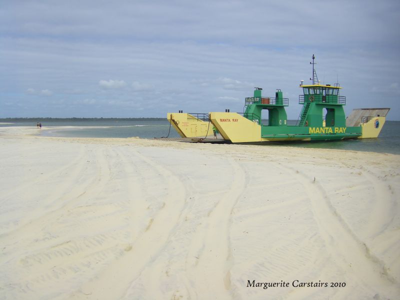
I went to see the Barges and find out about going across to Fraser Island. The Road was closed to 2WD, and after parking my vehicle in the parking area, I walked the sandy road to the beach where three barges waited for vehicles.
I asked about costs and was told $90 for a car and $45 for a motor bike, and then he smiled and said, free if you want a ride across.
So I happily waited for the barge to collect 4 motorbikes and some cars, and went across to see Fraser Island.
The Barges stop on the beach at the southernmost tip of the island, and vehicles drive off and away to Eurong over the white soft sands. I waited with the barge until it was time to return to Inskip.
Sea gulls dived into the water after fish. I walked in the sand and the water and enjoyed the beautiful island. The sand was as fine as silk, and is said to be great for cleaning jewelery with. The water was blue as blue. There is no camping on the beach at this point. One needs to go to Eurong and follow the hiking tracks from there.
Next trip I will bring my camping things and camp on the Island.
Manta Ray - Fraser Island Barges
Manta Ray Barge is a locally owned Fraser Island Barge service.
Manta Ray operate two Fraser Island Barges daily from 6.00am to 5.30pm.
The trip to Fraser Island from Inskip Point Rainbow Beach takes approximately 10 minutes and with two barges operating there is virtually no waiting.
The Manta Ray Fraser Island Barge service was started approximately ten years ago and continues to be owned and run by local operators. Initially set up to break a crippling monopoly of eleven years the Manta Ray Fraser Island Barge Service continues to keep the prices to and from Fraser Island to an affordable level so that everyone can enjoy its beauty. Like every small company we care for our customers
The Manta Ray Fraser Island Barge service is a small locally owned and independent Australian company and believe every Australian and also the overseas visitor should be able to enjoy the Fraser Island experience.
So, the next time you travel to Fraser Island, support the local Manta Ray Fraser Island Barge Service.
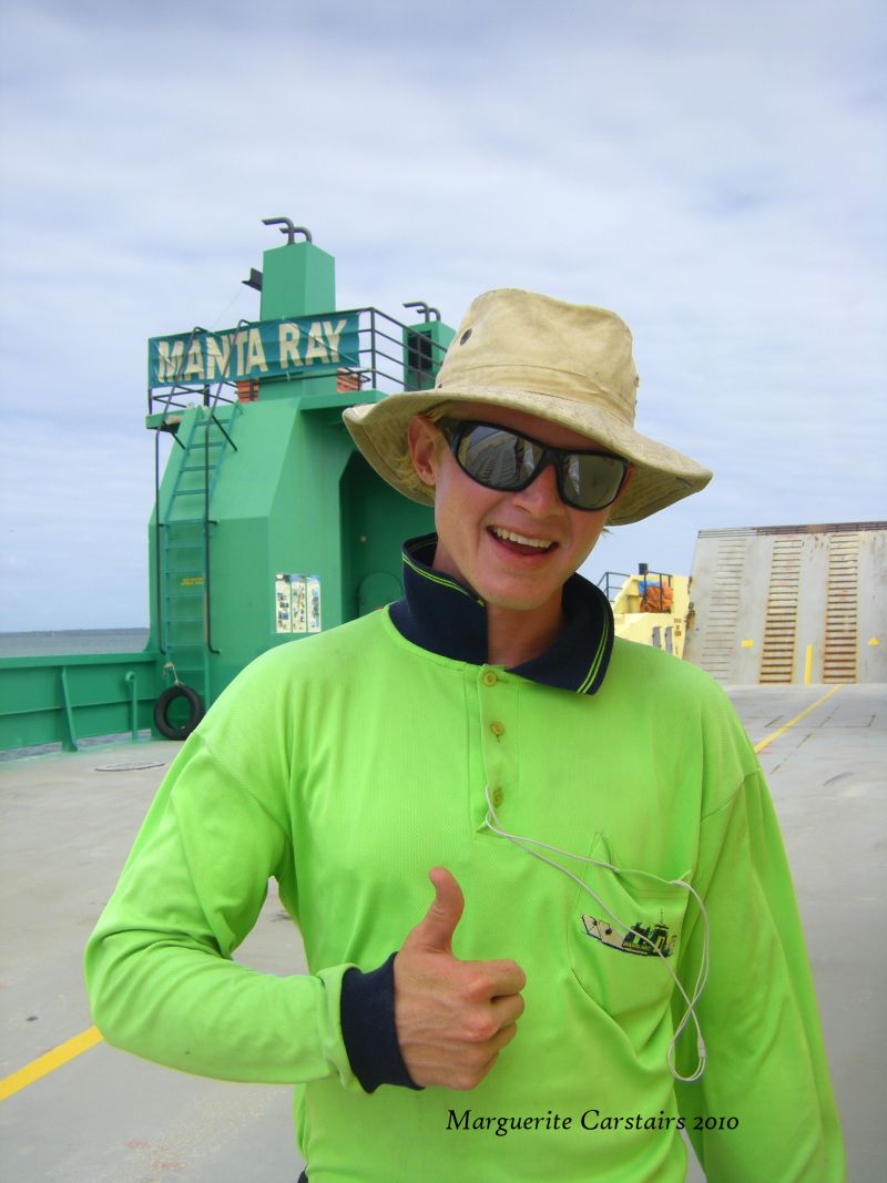
Just remember the Green and Gold which is the color of the Barges and the staff clothing
I went to see the Barges and find out about going across to Fraser Island. The Road was closed to 2WD, and after parking my vehicle in the parking area, I walked the sandy road to the beach where three barges waited for vehicles.
I asked about costs and was told $90 for a car and $45 for a motor bike, and then he smiled and said, free if you want a ride across.
So I happily waited for the barge to collect 4 motorbikes and some cars, and went across to see Fraser Island.
The Barges stop on the beach at the southernmost tip of the island, and vehicles drive off and away to Eurong over the white soft sands. I waited with the barge until it was time to return to Inskip.
Sea gulls dived into the water after fish. I walked in the sand and the water and enjoyed the beautiful island. The sand was as fine as silk, and is said to be great for cleaning jewelery with. The water was blue as blue. There is no camping on the beach at this point. One needs to go to Eurong and follow the hiking tracks from there.
Next trip I will bring my camping things and camp on the Island.
Manta Ray - Fraser Island Barges
Manta Ray Barge is a locally owned Fraser Island Barge service.
Manta Ray operate two Fraser Island Barges daily from 6.00am to 5.30pm.
The trip to Fraser Island from Inskip Point Rainbow Beach takes approximately 10 minutes and with two barges operating there is virtually no waiting.
The Manta Ray Fraser Island Barge service was started approximately ten years ago and continues to be owned and run by local operators. Initially set up to break a crippling monopoly of eleven years the Manta Ray Fraser Island Barge Service continues to keep the prices to and from Fraser Island to an affordable level so that everyone can enjoy its beauty. Like every small company we care for our customers
The Manta Ray Fraser Island Barge service is a small locally owned and independent Australian company and believe every Australian and also the overseas visitor should be able to enjoy the Fraser Island experience.
So, the next time you travel to Fraser Island, support the local Manta Ray Fraser Island Barge Service.
Just remember the Green and Gold which is the color of the Barges and the staff clothing
Labels:
australia,
Barge,
Dugongs Queensland,
Inskip,
Maggi carstairs,
Mantra Ray,
Rainbow Beach
Rainbow Beach,... Inskip Camping Grounds
http://www.rainbow-beach.org/
I arrived at Rainbow Beach around 6pm, and got the Camping permit from the IGA store. I drove to Inskip, a distance of about 12 kms from town along a deserted road, and as it was starting to get dark, turned into the first Camping spot. There was a tent on the left and a Caravan on the right overlooking the water, and I thought that is where I needed to be, right by the sea.
I turned right, and immediately sank into soft sand and got the wheels bogged.
A lady using a phone in a car offered to push me out, but then I saw a couple at a campfire, and asked him to help.
They dug into the harder sand, and pushed and after a few tries they pushed me out and told me to stay on the bark path. As it was now dark, I parked on the bark for the night.
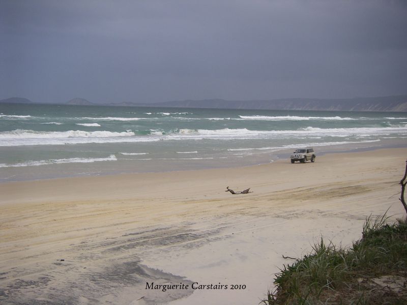
The sea was just opposite and all nigth you heard the waves breaking on the shore.
At Dawn, me and the camera went walking along the beach. It was beautiful. The sand soft and the waves wonderful along my feet. I was intending a swim, but I saw the blue bottles on the beach, and walked carefully after that.
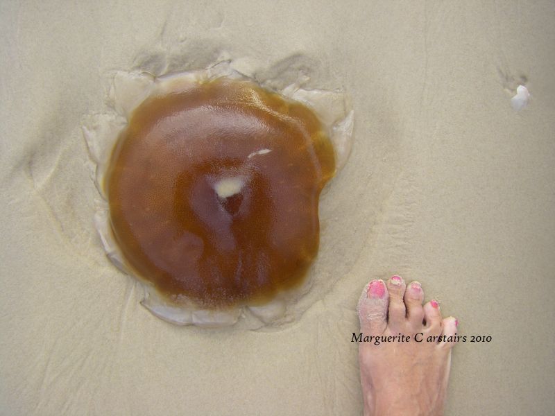
There were many bluebottles on the sand and a few huge brown jelly fish called 'snotties' by the locals.
Then the black clouds came and with it the rain.
Labels:
australia,
Dugongs Queensland,
Inskip,
Maggi carstairs,
Rainbow Beach
Thursday, February 18, 2010
Surfers Paradise
http://www.flickr.com/search/show/?q=surfers+Paradise&w=47552504%40N00
Surfers Paradise is in the Gold Coast and a wonderful place to visit and stay at.
Surfers Paradise (28°00′S 153°25′E / 28°S 153.417°E / -28; 153.417) is a suburb on the Gold Coast in Queensland, Australia. At the 2006 Census, Surfers Paradise had a population of 18,501.
Colloquially known as 'Surfers', the suburb has many high-rise apartment buildings and a wide surf beach. The feature of the central business district is Cavill Mall, which runs through the shopping precinct. Cavill Avenue, named after Jim Cavill, an early hotel owner, is one of the busiest shopping strips in Queensland, and the centre of activity for night life.
http://en.wikipedia.org/wiki/Surfers_Paradise,_Queensland
Labels:
australia,
Gold Coast,
Maggi carstairs,
surfers paradise
Friday, December 25, 2009
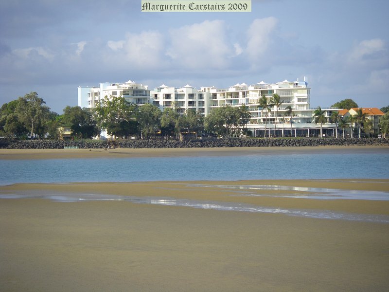
Sereniya Beach Burrum Heads
I drove down Orchid Avenue to the new Estate Called Sereniya Beach.
I walked across a bridge to the waters.
The tide was very low on the 22rd December.
The beach was totally isolated
I walked across a bridge to the waters.
The tide was very low on the 22rd December.
The beach was totally isolated
Wednesday, December 16, 2009
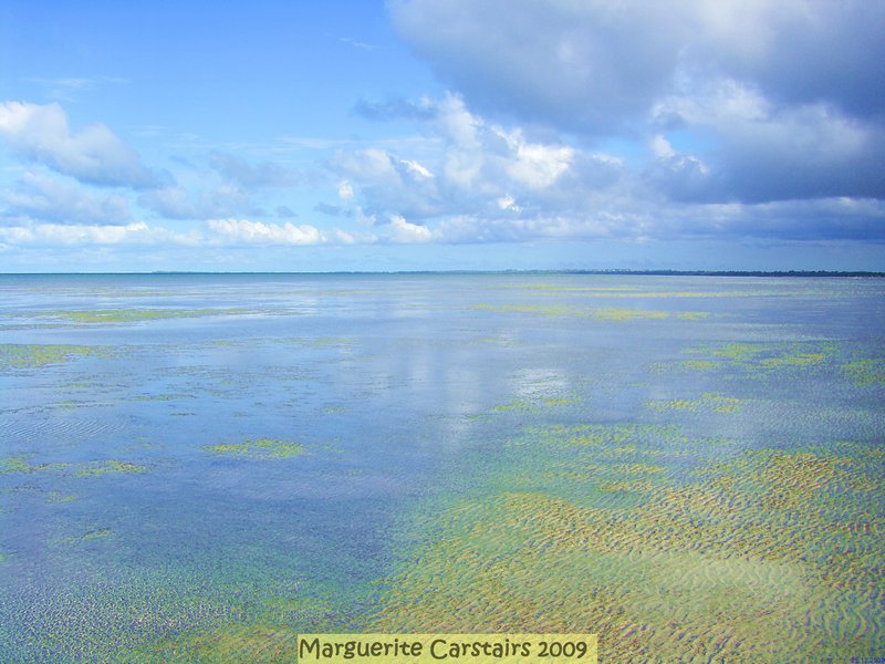
Low tide sand banks Hervey Bay
The colors of the sea were just beautiful...blue as blue.
The sand banks went out to sea a long way.
The colors of the sand and the sea were beautiful
The sand banks went out to sea a long way.
The colors of the sand and the sea were beautiful
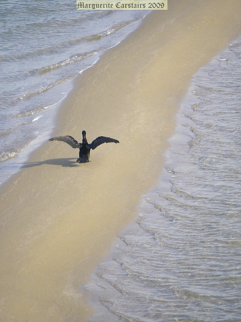
Shag dries his wings
On the sandbank at low tide at Hervey Bay
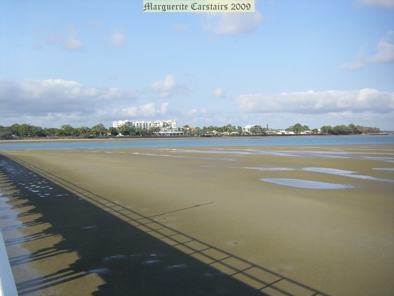
It was really low tide on the 14 December.
The sandbanks went more than halfway down Urangun Pier.
Two shags were very waterlogged. They rested on the sandbanks and dried their wings
It was really low tide on the 14 December.
The sandbanks went more than halfway down Urangun Pier.
Two shags were very waterlogged. They rested on the sandbanks and dried their wings
Labels:
australia,
dries wings,
Maggi carstairs,
shags
Gull eating fish
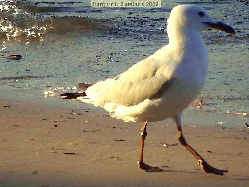
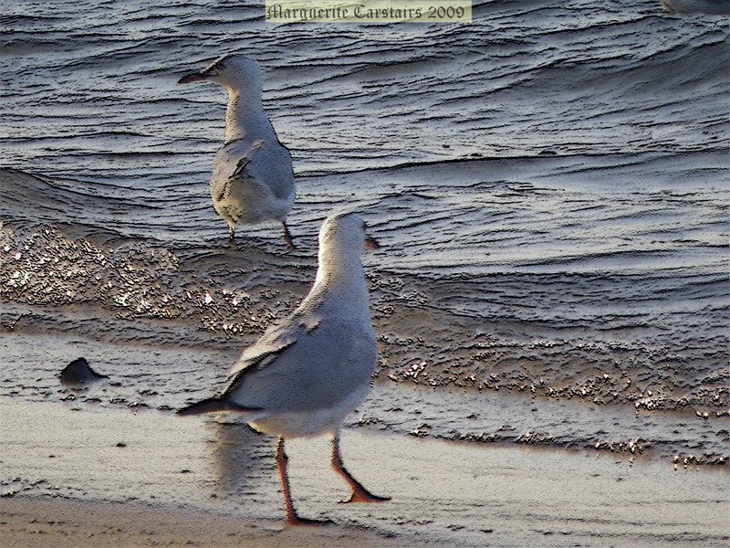
The seagulls had a wonderful time picking at the fish.
Labels:
australia,
Maggi carstairs,
Pacific gull,
Seagull
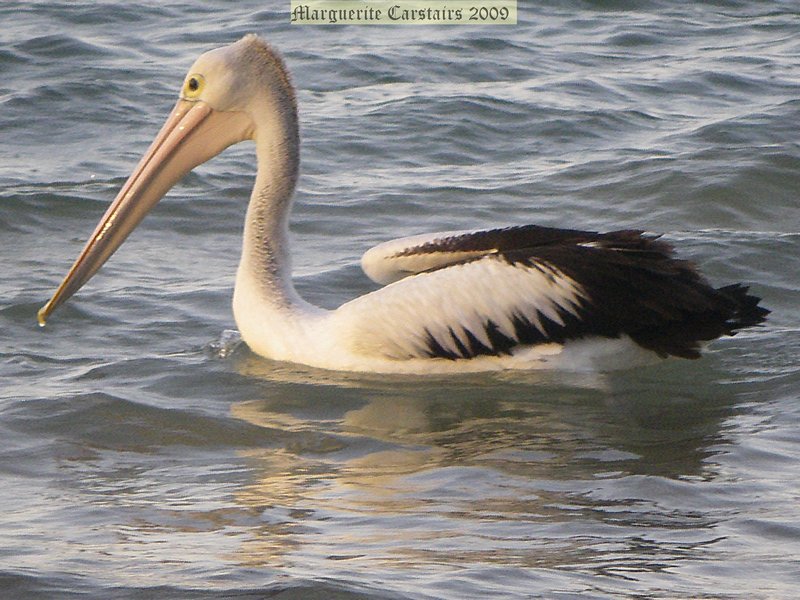
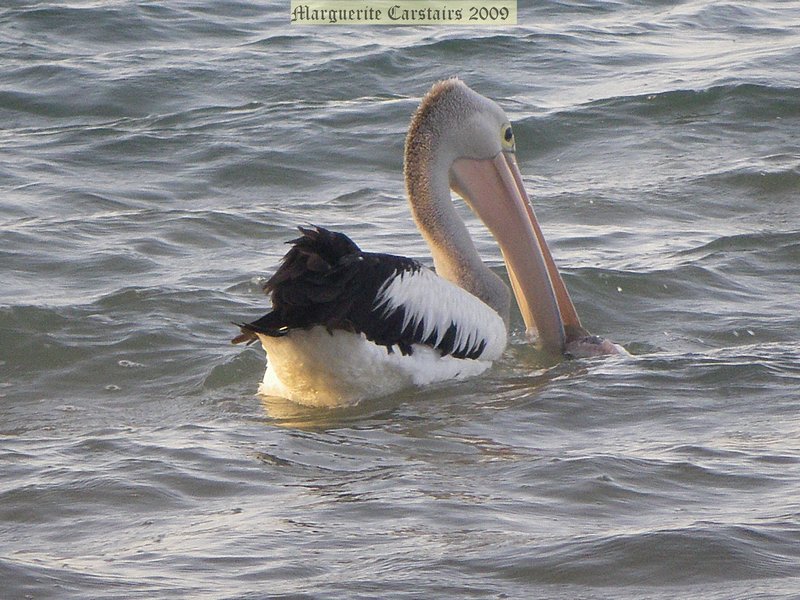
Pelican Burrum Heads Boat Ramp
This was an awesome experience
The day had been good for fishing, and five fish skeletons were left for the birds.
A pelican and a whole group of seagulls were on the shore after the fish.
I took many photos.
This is when the pelican walked to the shore, grabbed on of the fish and took it back out to sea to swallow it whole.
There are seven species of pelicans in the world, all of which are similar in shape and, with one exception, are primarily white in colour. Males are larger than females. The most characteristic feature of pelicans is the elongated bill with its massive throat pouch. The Australian Pelican's bill is 40 cm - 50 cm long and is larger in males than females. Pelicans have large wings and a wingspan of 2.3 m - 2.5 m.
Pelicans are highly mobile, searching out suitable areas of water and an adequate supply of food. Pelicans are not capable of sustained flapping flight, but can remain in the air for 24 hours, covering hundreds of kilometres. They are excellent soarers and can use thermals to rise to considerable altitudes. Flight at 1,000m is common, and heights of 3 000 m have been recorded. By moving from one thermal to the next, pelicans can travel long distances with a minimum of effort, reaching air speeds of up to 56 km/hour.
http://birdsinbackyards.net/bird/82
The day had been good for fishing, and five fish skeletons were left for the birds.
A pelican and a whole group of seagulls were on the shore after the fish.
I took many photos.
This is when the pelican walked to the shore, grabbed on of the fish and took it back out to sea to swallow it whole.
There are seven species of pelicans in the world, all of which are similar in shape and, with one exception, are primarily white in colour. Males are larger than females. The most characteristic feature of pelicans is the elongated bill with its massive throat pouch. The Australian Pelican's bill is 40 cm - 50 cm long and is larger in males than females. Pelicans have large wings and a wingspan of 2.3 m - 2.5 m.
Pelicans are highly mobile, searching out suitable areas of water and an adequate supply of food. Pelicans are not capable of sustained flapping flight, but can remain in the air for 24 hours, covering hundreds of kilometres. They are excellent soarers and can use thermals to rise to considerable altitudes. Flight at 1,000m is common, and heights of 3 000 m have been recorded. By moving from one thermal to the next, pelicans can travel long distances with a minimum of effort, reaching air speeds of up to 56 km/hour.
http://birdsinbackyards.net/bird/82
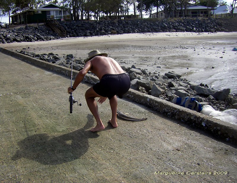
Flathead
It was a day for Flathead.
This fisherman used a cast net to catch live bait, which he them used to catch the Flathead.
He caught 4 good-sized fish, as you can see, and then left.
I happily took his spot..the best place to fish from on the second Ramp, and proceeded to lose 3 lures as they got snagged on the rocky ledge. He was using fresh bait, and next time I will too.
This fisherman used a cast net to catch live bait, which he them used to catch the Flathead.
He caught 4 good-sized fish, as you can see, and then left.
I happily took his spot..the best place to fish from on the second Ramp, and proceeded to lose 3 lures as they got snagged on the rocky ledge. He was using fresh bait, and next time I will too.
Labels:
australia,
Burrum Heads,
Fishing,
flathead,
Maggi carstairs
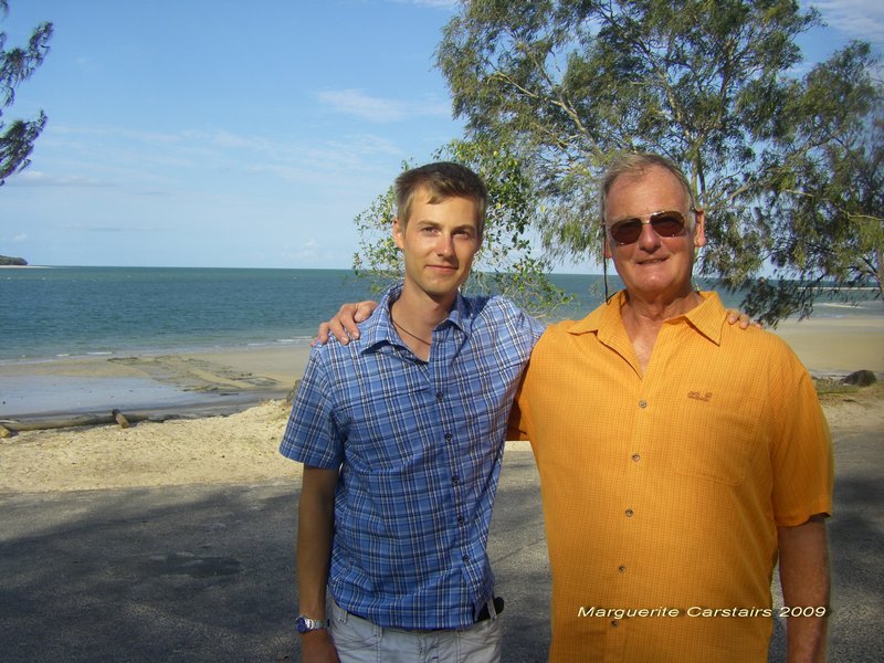
Traveler learns to fish
We both had fun learning how to throw the line out and reel it back in.
His father had a turn at fishing too.
Here is a great option for tourism...teach and show tourists how to fish.
I told them about the great fishing spots in Europe too.
Burrum Heads is the place to be for fishing, and everyone here, including me too now, has a fishing rod and knows about fishing.
It won't be long before I start a Fishing Blog with my new Interest and hobby...fishing
His father had a turn at fishing too.
Here is a great option for tourism...teach and show tourists how to fish.
I told them about the great fishing spots in Europe too.
Burrum Heads is the place to be for fishing, and everyone here, including me too now, has a fishing rod and knows about fishing.
It won't be long before I start a Fishing Blog with my new Interest and hobby...fishing
Labels:
australia,
Burrum Heads,
Fishing,
Maggi carstairs,
shore fishing
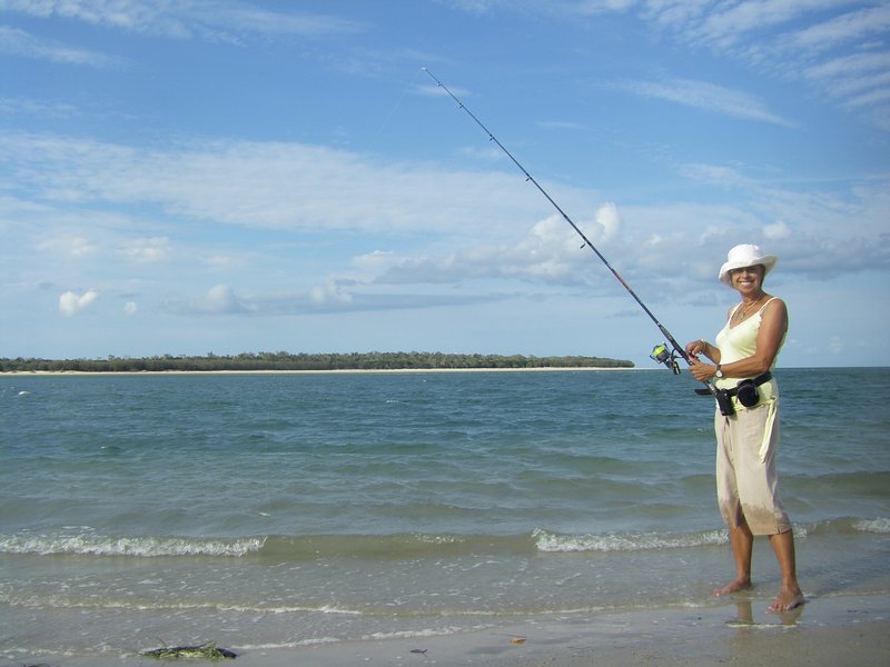
Maggi... using the new Fishing Rod for the first time
I have now taken up a new hobby...fishing
I was using Mike's rod but now have purchased my own rod.
Am still learning how to use it.
Two German tourists joined me, and we learnt how to throw the lures out into the water, where they got snared on the rocky ledge in front of the boat ramp. I lost 3 lures in one day.
I am using rubbery lures until I learn how to fish, as when I had bait, the little fish simply ate it all or it fell off.
The rod is rather nifty. It has a 12 lb line and many features, and cost $39.99
Last night Col showed me how to cast, so I now know how to throw a lure out correctly and hold the line for casting.
Soon I will catch my first fish by myself.
I love fishing and am learning how to fish.
I was using Mike's rod but now have purchased my own rod.
Am still learning how to use it.
Two German tourists joined me, and we learnt how to throw the lures out into the water, where they got snared on the rocky ledge in front of the boat ramp. I lost 3 lures in one day.
I am using rubbery lures until I learn how to fish, as when I had bait, the little fish simply ate it all or it fell off.
The rod is rather nifty. It has a 12 lb line and many features, and cost $39.99
Last night Col showed me how to cast, so I now know how to throw a lure out correctly and hold the line for casting.
Soon I will catch my first fish by myself.
I love fishing and am learning how to fish.
Labels:
australia,
Burrum Heads,
Fishing,
Maggi carstairs
Subscribe to:
Posts (Atom)


140x45.jpg)